Archaeology: Hidden Landscapes
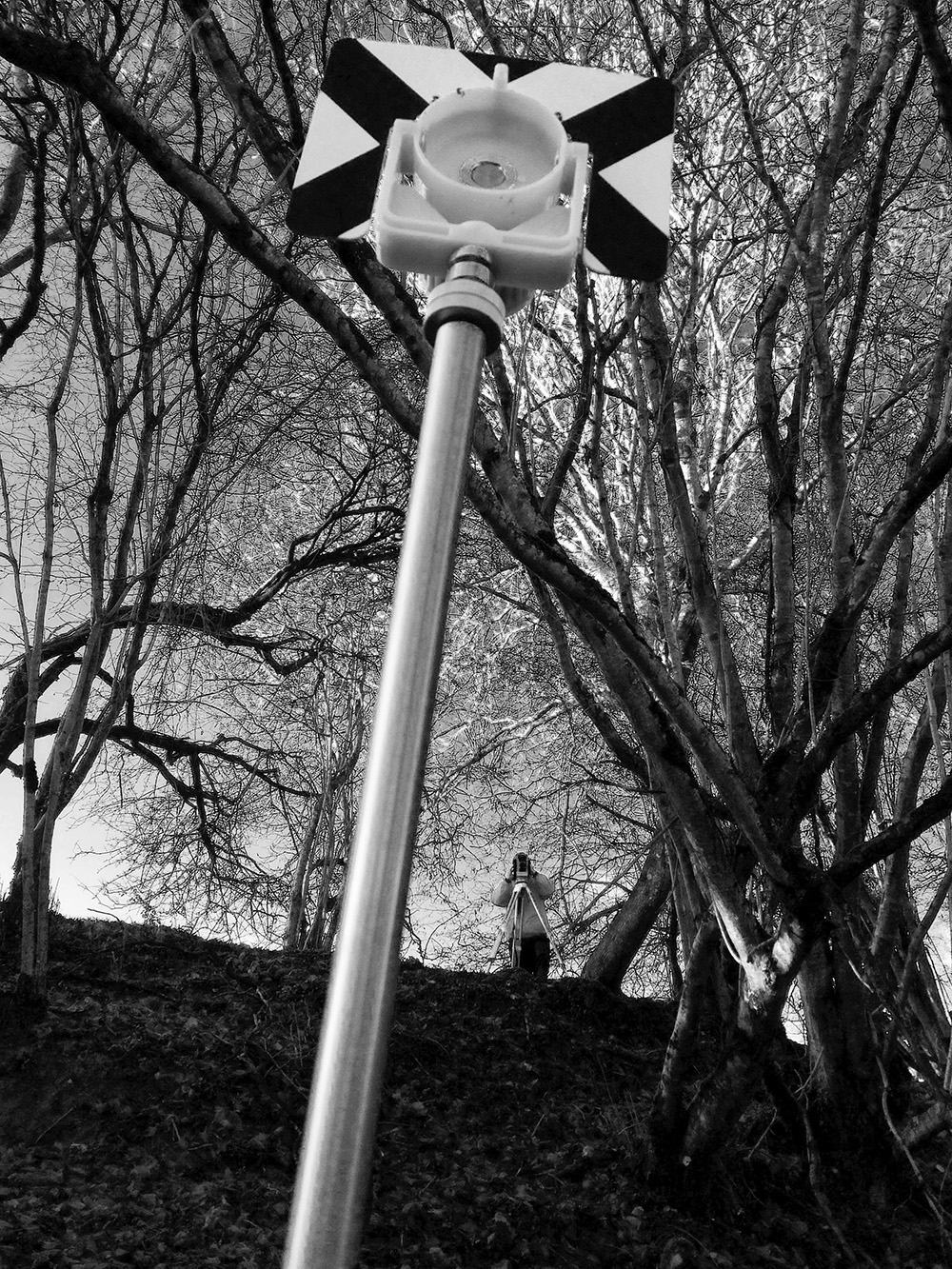
Our next instalment of the ‘Photo of the Week’ series features Ashely Green’s image which presents one of the key stages in surveying a site- georeferencing. The series is a weekly instalment, which features an image taken by our fantastic BU staff and students. The photos give a glimpse into some of the fascinating work our researchers have been doing across BU and the wider community.
Ashely’s research is looking at the potential to detect burials prior to archaeological excavation. She is doing this by producing software that automatically detects grave-like responses in geophysical collections of data. The software will use data from sites across Ireland and South-West England to describe the geophysical signatures of medieval burial practices. These sites are surveyed at a high-resolution with a range of techniques to determine what lies beneath the ground surface and how this may affect the detection of burials. This research aims to lessen the negative impact of modern activities on these burial sites.
This photo presents a key stage in surveying a site – georeferencing, where the survey grids and elevation profile coordinates are recorded to be associated with the corresponding geophysical data.
If you’d like find out more about the research or the photo itself then please contact Ashely.
This photo was originally an entry to the 2017 Research Photography Competition. If you have any other questions about the Photo of the Week series or the competition please email research@bournemouth.ac.uk
 Photo of the Week: This is me. I am Ron.
 Photo of the Week: Tiddles- the playful data analyst!
 Photo of the Week: Dramaturgical study of ‘Game of Thrones’
 Photo of the Week: Improving Vehicle Transportation Safety and Security


 New interdisciplinary paper accepted for publication
 Poverty in the UK: book launch today at BU
 BU contributions to successful Global Health conference
 Horizon Europe Cluster 3 (Civil Security for Society) 2026 Calls Now Open
 MSCA Doctoral Networks 2026 Call Information Webinar
 Reminder: Register for the ESRC Festival of Social Science 2026 Information Session
 ECR Funding Open Call: Research Culture & Community Grant – Apply now
 ERC Advanced Grant 2025 Webinar
 Update on UKRO services
 European research project exploring use of ‘virtual twins’ to better manage metabolic associated fatty liver disease