 Congratulations to colleagues on the recently funded project “Human Henge: Historic landscapes and mental health at Stonehenge”. This research led by the Restoration Trust. The project has been funded by the Heritage Lottery Fund, English Heritage Trust and Wiltshire County Council and has multiple partners and contributors including Wiltshire County Council, Richmond Fellowship, English Heritage Trust and Bournemouth University. From BU, Prof Tim Darvill (Director Centre of Archaeology, Faculty of Science & Technology) and Dr Vanessa Heaslip (Faculty of Health & Social Sciences) are engaged in this project.
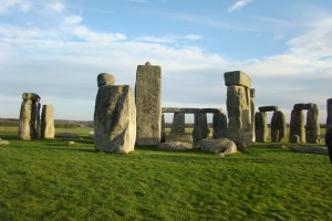
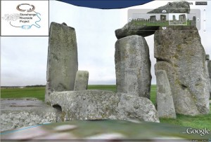
The Human Henge research project is a therapeutic sensory experience of Stonehenge for two facilitated groups, each of up to 16 local people with mental health problems, plus carers, support workers, volunteers and staff. Over ten weekly three-hour sessions, one at night, each group walks the landscape, reaching through time to other humans whose traces are illuminated by accompanying pre-historians, curators and artists. Individual experiences cohere in a shared spoken epic which is augmented from session to session. The groups arrive inside the Stone Circle near the winter solstice and spring equinox; collaborating with their chosen artist, they decide what they do there.
Congratulations!
Prof. Edwin van Teijlingen
CMMPH


 Today is my first day back in the office after a road trip from Vancouver to Los Angeles, taking in many exciting cities, national parks, activities, etc en route. From spotting killer whales in the San Juan Islands to making the most of tax free shopping in Portland to hydrobiking in Long Beach harbour, I’ve packed in lots of fun! One of the coolest things we did, however, was to go to the
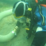 Dave Parham
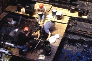
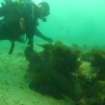 The wreck has been featured on the One Show (6 April 2011) where presenter Dan Snow took part in a dive on the wreck in the mouth of Poole Bay alongside a team of BU Marine Archaeologists, led by Dave.
 Dave will also feature in the fourth episode of Britain’s Secret Seas, The Bustling South, on 29 May at 8pm on BBC2.
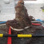 After conservation, finds from the Wreck and all the information from the excavation will be passed on to


 Poverty in the UK: book launch today at BU
 BU contributions to successful Global Health conference
 New paramedic science paper by BU’s Dr. Ursula Rolfe
 Horizon Europe Cluster 3 (Civil Security for Society) 2026 Calls Now Open
 MSCA Doctoral Networks 2026 Call Information Webinar
 Reminder: Register for the ESRC Festival of Social Science 2026 Information Session
 ECR Funding Open Call: Research Culture & Community Grant – Apply now
 ERC Advanced Grant 2025 Webinar
 Update on UKRO services
 European research project exploring use of ‘virtual twins’ to better manage metabolic associated fatty liver disease